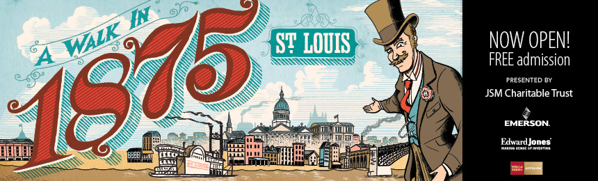
SCHS will visit the exhibit at the Missouri History Museum, “A Walk in 1875 St. Louis” two times in September, Wednesday the 9th and Saturday the 19th. Graphic from http://mohistory.org
The Missouri History Museum, seen in photo below, might be known to some people as the Jefferson Memorial, is located in Forest Park. Its current flagship exhibit is “A Walk in 1875 St. Louis,” which runs until February 15, 2016. SCHS will visit the exhibit two times in September, Wednesday the 9th and Saturday the 19th, both starting at 10:00 am. Both tours are the same. The choice of date is yours. Come to either or both. See more about the trip on the page, Hold that Pose, St. Louis!
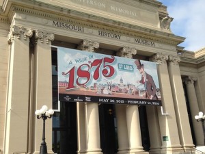
Missouri History Museum with banner for “A Walk in 1875 St. Louis” From:http://www.ksdk.com/story/news/2015/06/03/new-exhibit-uses-combo-of-famous-map-and-graphic-novel-illustrator-to-create-a-dazzling-history-lesson/28397001/
The maps are enlarged from coffee table size to 10 by 30 feet, mounted on the exhibit walls and backlit. They glow out into the room creating a warm atmosphere and they are easy to “read.”


Each map represents a St. Louis “neighborhood” with nine neighborhoods represented. There is an interpretive guide for each map that gives more in-depth information on certain sites and features. See which nine neighborhoods are represented.


There is a copy of the Compton and Dry map book in its original size that visitors can lay hands on and flip through. There are two digital screens showing the maps. Using the controls, visitors can zoom in on the maps to see more detail.
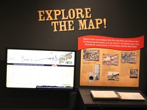
Page through a copy of the book of maps, or see the maps on a large interactive screen. Map book on right and interactive screen on left.
The illustrations, in graphic novel style, by Dan Zettwoch provide large splashes of color to the exhibit, which provides a sharp contrast to the detailed black and white maps. The illustrations quickly draw in the attention of the viewer and show the every day life for people living in 1875 St. Louis. Some of the topics covered in the graphics are shown below. See what other topics are explored in the graphics on page, other topics.


Actual real objects appear here and there through out the exhibit along with the graphic illustrations. The objects almost become a part of the illustrations.


Additional information
on the web about the exhibit, “A Walk in 1875 St. Louis,” the Missouri History Museum, and other information about the Compton and Dry pictorial maps of 1875 St Louis.
Learn more about the exhibit on the Missouri History Museum web site.
See many of the sites from the 1875 pictorial maps featured on the Missouri History Museum Facebook page.
Dig deeper into the exhibit with the Missouri History Museum blog on “A Walk in 1875 St. Louis.” especially the following posts.
- History Happens Here article: Why 1875?
- History Happens Here article: Beneath the Feet of 1875 St. Louis
- History Happens Here article: Keeping 1875 St. Louis in Order
- History Happens Here article: Stepping Onto 139-Year-Old Streets
- Behind the Scenes video: The Making of A Walk in 1875 St. Louis
- Introduction video: A Walk in 1875 St. Louis – Exhibit Trailer
See great photos of the exhibit at wheretraveler.com
See a fine review of the exhibit at stlmag.com “Time Travel by Cartography: ‘A Walk in 1875 St. Louis’ at the Missouri History Museum” by Chris Naffziger June 3, 2015
See the feature on the exhibit done by St. Louis Public Radio, “New exhibit shows what St. Louis looked like in 1875” by Evita Caldwell, June 2, 2015, including the interview with exhibit curator, Andrew Wanko.
See a great collection of photos of the exhibit at KSDK web site.
See review of exhibit at stltoday.com
Learn more about exhibit illustrator on his web site Dan Zettwoch or on his Twitter page, https://twitter.com/danzettwoch.
